
Ha Giang Loop: A Journey through Vietnam’s Northern Frontier
Ha Giang Loop is a must visit destination as it is the final frontier of Vietnam. Let us take you on a journey to the otherworldly landscapes of this province.
Everything was white washed in fog under the 14 degree weather on a chilly Saturday afternoon. Almost every landscape seemed unreal as if it was taken out from a Chinese ink wash painting.

We couldn’t help but be in awe of everything we see. Furthermore, we gazed our eyes upon the plunging canyons, the receding mountain ranges, and the silky white roads snaking out from steep mountain passes.

Dong Van Karst Plateau Geopark
This area was once a witness to the bloodshed between China and Vietnam during and after the 1979 Sino-Vietnamese War. As a result, the war has claimed thousands of lives between the two countries.


This politically sensitive border has been far from the reach of travelers. But as of today, it is now slowly accepting tourists into their striking landscapes and its spectacular mountain passes.

Because of the UNESCO funding, the roads are now paved. Subsequently, it has now interconnected three discovery routes that is offered to the travelers alike, making it even more easier to traverse the park.
This made the northern border now more open to the world. Moreover, one can discover not just the colorful landscapes but as well as to know the seventeen (17) ethnic minorities residing in this part of Vietnam.

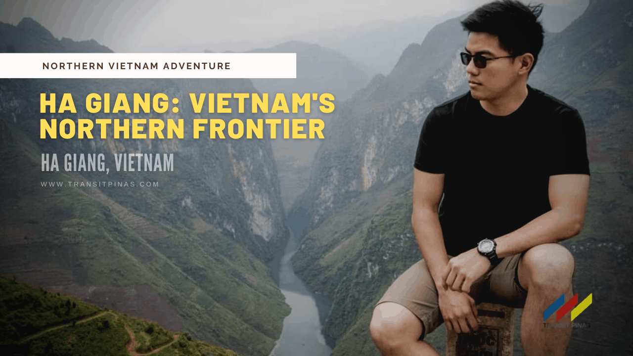
The UNESCO-listed Dong Van Karst Plateau Geopark covers approximately 2,350km2. Also, this is located in the province of Ha Giang in Vietnam which is around 6-7 hours north of Hanoi.
The most striking feature of this geopark is the ensconced karst mountains and rocky outcrops at around 1000-1400MASL. Although it’s geology is similar to that of the Ha Long Bay, the geopark still remains pristine.

Route 1: Road Up Earth’s Fecundity
Our journey was staged from Sapa, after a quick yet disappointing visit to the summit of Mt. Fansipan (3143+).
We took an overnight sleeper bus to Ha Giang City, the provincial capital, where we alighted at our host, the Ha Giang Green Hill Hostel.


Half an hour along the now winding and steep roads, we took the Route 1, which is “The Road Up Earth’s Fecundity”. First stop, the Quan Ba Pass which is also known as the “Heaven’s Gate”.

Fog still covers up much of the area, the sun is hardly seen that morning. Undoubtedly, the first astounding vista, the Fairy Bosom, is now right in front of us.
Two rounded breast like hills were formed on the valley of Tam Son Town. The Fairy Bosom stood side by side as it is surrounded by intricate patchwork of fields.

Right after, we continued our journey down to Tam Son Town.
Route 2: Life Melody in A Rocky Kingdom
Upon arrival in Yen Minh town, we stopped over for lunch, where we had our first legit offering of Vietnamese cuisine.

Somewhere along the meandering roads of Yen Minh, we took a quick stopover. “You, look there” Bing pointed at a group of people, mostly female Hmong people tending a rocky outcrop. “They are planting Corn, Hmong People always plant Corn”.
I noticed that although the landscape was mostly rocky and harsh, they still found a way to make good use of it.

Most of the Hmong people carry it around their backs – the husks, corns, grasses, nothing really goes to waste.


But then again, as we traversed this route on the last day of our stay, I could really say that this place rocks!
There’s much to see and places to go along the way. Not only the famed Tham La Pass but there’s also the Moon Surface, Hmong King Palace to name a few.

Route 3: Sky Journey To Pride and Happiness
Weather was not cooperating that day, but we still pursued to visit one of Vietnam’s four dangerous mountain passes, the Ma Pi Leng Pass.
This mountain pass is the dangerous of the bunch, it has an elevation of over 1000 meters. In fact, it tops the 50km long Ô Quy Hồ Pass that gradually ascends to Sa Pa Town.

From Meo Vac where we had a brief stop over for a cup of Ca Phe Sua Nang (Hot Coffee with Milk). Finally, we found ourselves navigating a rather challenging path along the mountain passes.
Down below was the glass like flowing surface of Nho Que River. The pale aquamarine color of the river was contrasted by the bucolic green and ghastly fog of the canyon.

Along the Ma Pi Leng Pass, a number of view points are worth a stop. In my opinion, my photos can’t justify how beautiful it really is in person, might as well see it for yourself the next time around!

Hmong Ethnic Market
We arrived in Dong Van Town that same day and settled down in Lam Tung Hotel for the night. For this reason, we celebrated over generous servings of meat and vegetable in Hot pot they call Lau. In addition, we then partnered it with Corn Wine or, yes you heard it right, the infamous, Happy Water.


The following day we visited the Hmong Ethnic Market before venturing out into the northernmost point of Vietnam. It was a rather vivid scene like taken straight out from a history book.
Hill Tribes from outlying villages congregated on a Sunday Market trading chicken, buffaloes, pig, produce and lots of unique stuff. From their peculiar head scarfs, their sequined vests, down to their colorful skirts and traditional outfits – this must be the most ethnically diverse province in Vietnam.

Lung Cu Flagpole
Around 20 kilometers from Dong Van, lies the Lung Cu Flagpole, where the flag of Vietnam flutters greatly on a fine windy day.

But it was rather gloomy that time with the thunder clouds foreboding from a distance, that we took a quick visit then dropped a while at the Vietnam-China Border Belt before eventually taking a long ride back to Ha Giang City.

You shouldn’t miss this province when dropping by in Hanoi, Vietnam. Aside from the unique striking features of the Dong Van Karst Plateau Geopark, there’s also the people and the culture. Furthermore, the place is a thousand fold different from what we experienced down in the bustling city center.

Will definitely go back, what an awesome TRANSIT!
How To Get There
- Sleeper buses regularly connect Hanoi to Ha Giang Province in My Dinh Bus Station. Ttravel takes around 6-7 hours on a 300+ kilometer road with minimal bus stops.
- Upon arrival in Ha Giang, local mini buses goes up to the town of Quan Ba, Yen Minh, Meo Vac and Dong Van but I highly suggest to do the loop by renting your own vehicle.
- One can rent motorcyles or a car to explore the UNESCO inscribed site.
- You can try to book your car or motorcycle in advance just like what we did through Ha Giang Green Hill Hostel.
![]() Hanoi, Vietnam: Underneath the Nón Lá – located on the eastern Indochinese Peninsula, this was once a French city often dubbed as the “Paris of the East”, a gateway to a plethora of natural wonders, people, culture and amazing food. From rich forests, karst and tectonic landscapes, towering mountain peaks, UNESCO listed sites, ethnic markets, and effusive local hospitality – let us take you into an adventure of a lifetime up into the northern reaches of Vietnam!
Hanoi, Vietnam: Underneath the Nón Lá – located on the eastern Indochinese Peninsula, this was once a French city often dubbed as the “Paris of the East”, a gateway to a plethora of natural wonders, people, culture and amazing food. From rich forests, karst and tectonic landscapes, towering mountain peaks, UNESCO listed sites, ethnic markets, and effusive local hospitality – let us take you into an adventure of a lifetime up into the northern reaches of Vietnam!
This is my third country visited last March 22 to 26, 2019.
Northern Vietnam Adventure Series 2019
The Roof of Indochina: Mt. Fansipan Travel Guide 2019
Ha Giang Loop: A Journey through Vietnam’s Northern Frontier
Ha Giang: A DIY Budget Travel Guide to Vietnam’s Final Frontier
Ha Giang’s Quan Ba Fairy Bosom
Mã Pí Lèng: The Legendary Mountain Pass Above the Clouds
Ha Giang’s Ethnic Rendezvous: Dong Van Sunday Market
Lung Cu Flag Pole: Vietnam’s Last Vestige
Hmong King’s Palace – Vietnam’s Golden Triangle Opium Link
Hanoi, Vietnam: One Night Only in the Charming Old Quarters
Inside the Bay of Dragons: Ha Long Bay, Vietnam
Have you tried the Ha Giang Loop in Vietnam? How was it? Share your awesome stories in the comments section below!


