
Taal Volcano | Inside the Third Order Volcanic Wonder
Taal Volcano is an active and complex volcano system that has recorded 34 eruptions for the last 400 years. This is located in the province of Batangas. In this adventure let me take you inside the island before the 2020 eruption.

UPDATE: The Taal Volcano has been closed to the public.
Not The World’s Smallest Volcano
Taal Volcano, as depicted in our textbooks and postcards, has misled generations of Filipinos that it is indeed the smallest volcano in the world. But mind you, what we saw as a child is that of only the Binintiang Malaki, a cinder cone of Taal Volcano.

To say Binintiang Malaki is not the volcano, you also got it wrong. Binitiang Malaki is also Taal Volcano. Moreover, Taal Volcano has 47 overlapping cones and craters – 26 of these are tuff cones, cinders, and maars.

Furthermore, this is the site of the 1707, 1715, 1749, and 1754 eruptions.

According to PHIVOLCS, Taal Volcano is the whole island as well as the entire caldera surrounding Taal Lake.
Debunking the myth that it is the smallest volcano: Taal Volcano’s caldera measures 25 kilometers across, while Mt. Mayon’s base in Albay is only 17 kilometers across. Mt. Pinatubo’s caldera, on the other hand, measures 2.5 kilometers across.
Consequently, Taal Lake measures 23,420 hectares, making it the third-largest lake in the country. Thus, Taal Volcano could be very well one of the largest volcanoes in the world.
Mt. Tabaro and the 1965 Base Surge
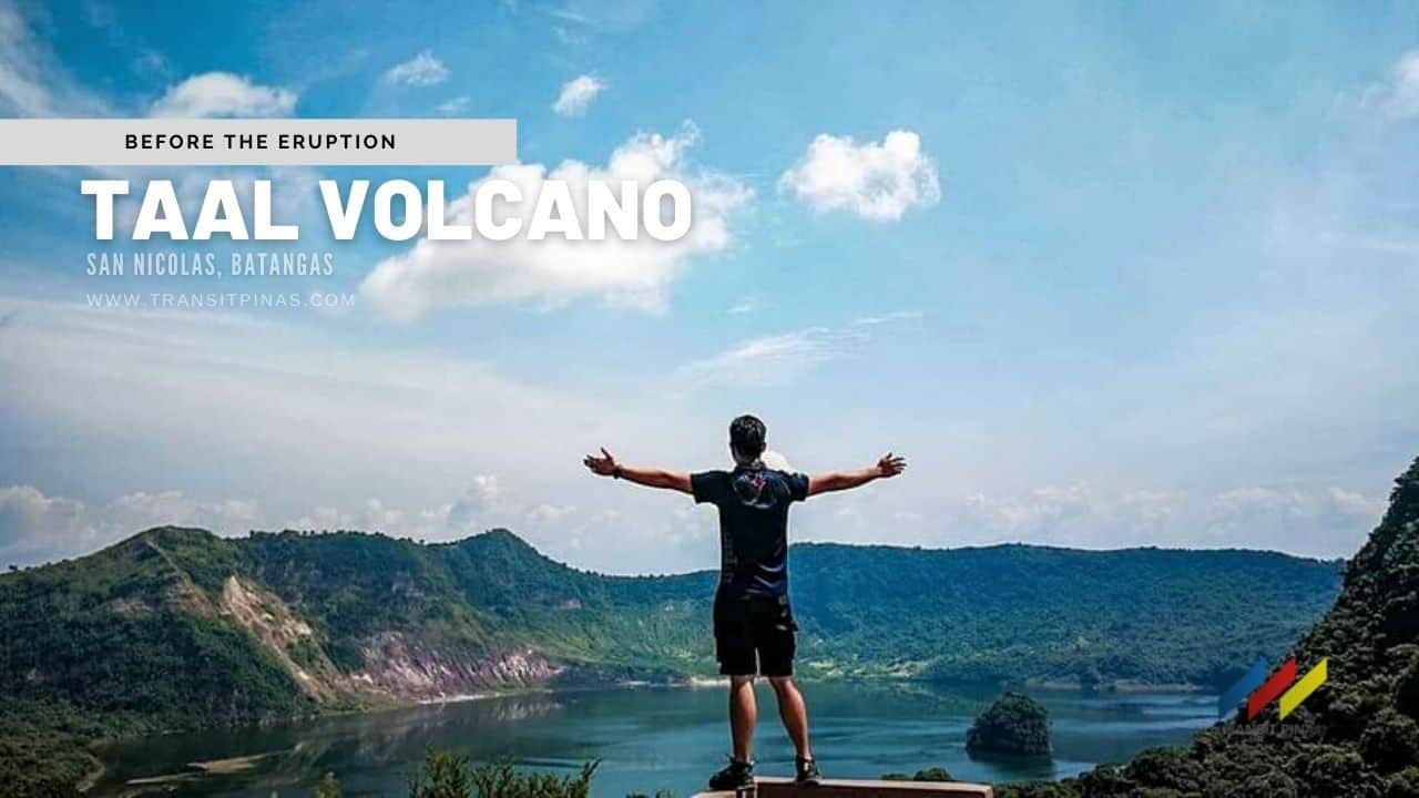
Last September 2017, we visited Taal Volcano via the San Nicolas, Batangas jump-off.


We were welcomed by the tourism officer and had an orientation before we transferred into an outrigger boat going to the island.


The surrounding trees on the island were a sanctuary for migratory birds such as the White Egrets we saw along the lake.


At the jump-off point, we were then welcomed by our guides and started the trek. First off on our trek is the site of the black lava fields with a boardwalk ending into a view deck.


Then half an hour later, we found ourselves scaling a heart-shaped crater in the middle of the island, this is called Mt. Tabaro.


Mt. Tabaro is the site of the 1965 phreatomagmatic eruption which caused violent base surges that killed hundreds of people and devastated villages along the lakeshore.

The Yellow Lake
Inside Taal Lake is the Vulcan Point, a rocky outcrop that is a remnant of the previous eruptions. Moreover, it is said to be an island within a lake within an island within a lake within an island. A third-order island. Phew

The Main Crater of Taal lake has been a favorite tourist destination where it can be accessed through Daang Kastila fronting Talisay, Batangas.

But we visited the island via San Nicolas, Batangas which gave us access to the crater lake’s shores.


This is said to be the largest double lake in the world. This is also the site of all the main eruptions of the Taal Volcano in the past hundreds of years.


Swimming is not allowed in the lake. Also, PHIVOLCS said that the water has high diluted amounts of Sulfuric acid with toxic concentrations of Boron, Magnesium, Aluminum, and Sodium in salt form. In its placid waters, there are no fishes that can thrive.


The 2020 Eruption
On the afternoon of January 12, 2020, the Taal Volcano erupted after a 43-year rest.


It generated volcanic lightning above its main crater with ash clouds reaching nine miles into the sky. Subsequently, it progressed into a magmatic eruption in the main crater with lava fountains with thunder and lightning.


The eruption spewed ashes to Calabarzon, Metro Manila, some parts of Central Luzon up to Pangasinan and Ilocos Region.

Taal’s Yellow Lake vanished after the eruption because the water seeped into the fissures following the earthquakes. But it has returned after a series of typhoons and rains visited the area.

The once green and thriving island became what seemed like the surface of the moon.
From ashes to ashes, dust to dust.
 Updated January 12, 2022

