
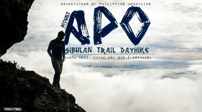
Mindanao’s Grand Sage – Mt. Apo (2954+), Davao Del Sur
Mt. Apo, standing 2954 meters above sea level, is a climb any outdoor nomad shouldn’t miss.
I bowed down before the Grandfather of Philippine Mountains. I could not help but feel this kind of fulfillment as I stand on the pinnacle of the highest mountain in the country.
It has its fair share of mossy forests, boulder faces, solfataras, sea of clouds and majestic sunrises and sunsets above its several peaks. This is definitely a dream mountain worth climbing for.

MT. APO (SIBULAN BACKTRAIL DAY HIKE)
Sta. Cruz, Davao del Sur
Jump-off Point: Sitio, Colan, Brgy. Sibulan, Sta. Cruz, Davao del Sur
LLA: 7°0′30″N, 125°16′33″E, 2,954 MASL (#1)
Days required / Hours to summit: 1-3 days / 14-16 hours
Specs: Major Climb, Difficulty 8/9, Trail class 2-4
(www.pinoymountaineer.com)
Manila to Digos, Real Quick
For the longest time, I’ve always wanted to scale the rooftop of the Philippines. Our hike required careful planning and feasible logistics. We didn’t want to join organized tours since we want to do it the DIY way. This is much cheaper option, albeit the planning.

We arrived in Davao International Airport half an hour past eight in the evening. Then met with our guide, Sir Clyde Singson who arranged for our permits prior to our arrival. After a short briefing, we then boarded the taxi he rented to take us to Digos, Davao Del Sur.

Upon arrival in Digos City, some 45 minutes later, we met another friend based in General Santos City. Around 01:00 am, our Habal-Habal rides arrived where we loaded our bags and squeezed in atleast three (3) persons on each motorcyle.
It took two (2) hours of butt-numbing motorcycle ride under a carpet of stars. Upon arrival at our guide’s house, he then treated us with generous servings of hot coffee and chocolate. And from there, we again rode the motorcyles and traversed the rough roads leading to the foot of Sitio Colan, some 30 minutes away.
Sitio Colan
We then started the hike at 02:45 in the morning, the first part was rather exhausting as we haven’t had any decent rest. The trail is gradually steep until we reached Sitio Colan, almost half an hour later.
We then registered with the park officials stationed in the sitio before we pushed forward to Sitio Tumpis. It was now a rather pleasant hike as we walk under the evening sky with the galactic core swinging by in all its cosmic glory.

Although we got sleepy and dead tired at some points along the trail, time seemed to pass us by easily. We zoomed across the forest covers leading to the first campsite called the Tinikaran some three hours after Sitio Colan.
Tinikaran Campsite
The sun slowly lit the once lurid sky foreboding with morning rain as we arrived by 06:00 am in the now lively campsite. It was a fairly sizeable campsite and also where some mountaineers spent the night prior to their descent.


What I missed during that morning rush was that the forest was more alive than I have ever thought. Trees are quite different from the ones we usually encounter and most of them are covered in moss. Sir Clyde then prepared coffee for us while we had some much deserved breakfast.


Thirty minutes of rest was more than enough to wake up our sleeping souls. Onwards to the second campsite.

Across Acrid Fields of Yellow
The trail we took for this hike was via the Sibulan Trail or commonly known as the Sta. Cruz Boulderface. This is one of the difficult trails leading to the summit. Sta. Cruz has large concentrations of boulders and sulfuric vents than any other trails in Mt. Apo, but it is shorter than the others.


Upon arrival at the Tinikaran Campsite II, the boulder face is now within reach. This is said to be the toughest part of the ascent. By 07:15 in the morning, we have finally arrived at the boulder face.

From here the landscape slowly changed dramatically. The once lush forests covered in moss and various plants, changed to rocky boulders. Passing by the first part, a sulfur vent is now seen pumping hot sulfuric gases from its small crevice.


Then clouds started to swoop down and revealed the surrounding mountains and sea across the peninsula. It was rewarding up there.


The boulders are now becoming even more larger, hopping from one to another becomes a little bit more challenging.

Wild berries now sprouted from small shrubs across the rocky trail. Two hours across this otherworldly boulder face, the hike is now taking a toll on us.


Infested in sulfuric haze that comes in acrid billows of yellow smoke, Oxygen gets a little bit more thinner by the minute. Breathing normally becomes a rather hard task to do at this point.


By 09:15am we have finally arrived in the White Sand Camp. A few more meters away from the summit where we had a much needed break. The temperature now dropped as we ascended a little bit more higher this time. Scrambling along the steep rock section going to the summit.


The King Peak
Although the backpacks we are carrying aren’t as heavy as the full packs the mountaineers along the way are carrying. It felt like it is five times heavier this time.
Every five to ten steps I take, the longer it takes for me to rest. I took the liberty to just rest along the way every time my lungs are complaining from the lack of oxygen.


Half an hour passed, I have reached the shallow ancient crater lake of Mt. Apo. Traces of the fire happened last 2016 in this area., and is evident by the scorched rocks and plants.
At this point, the gargantuan walls of the ancient volcanic crater is now cradled by the wind blowing past against us. We wore our wind-breaker jackets to keep us warm and just kept on moving.


A little bit more panting and few more baby steps, we have finally reached the Sta. Cruz Peak of Mt. Apo!
This is one of the toughest hikes we’ve ever done, and this took us almost eight (8) hours with minimal breaks (except at the Campsite I and White Sand).


The Kidapawan peak, where the famous signboard lies, is another mountain away. Our group all agreed to just climb it next time since we are pressed on time. We still have to reach Sitio Colan before sundown to stick on our itinerary.

From here the grand vista of clouds are seemingly endless. Mt. Matutum of South Cotabato lies in quiet repose among its surrounding fields. The sinister boulder face from down below is still consumed in sulfuric haze.
Origins of Apo Sandawa
The mighty peak and its surrounding areas of concerns falls under the jurisdiction of two (2) Regions, namely:
- Davao City, Bansalan, Digos City and Sta. Cruz, all in the Province of Davao del Sur in Region XI
- Makilala, Magpet, and Kidapawan City, all in the Province of North Cotabato in Region XII.
There are five (5) known entry points to the Mt. Apo Natural Park, and is managed by local LGU’s in accordance to PAMB Resolutions and are as follows:
- Via Sibulan – Tudaya Trail , Sta. Cruz, Davao del Sur, Region XI; (Our Trail for the day)
- Via Kapatagan Trail, Digos City, Region XI;
- Via Kidapawan – Ilomavis, Kidapawan City, Region XII;
- Via New Israel – Makalangit, Makilala, North Cotabato, Region XII;
- Via Bongolanon Trail, Magpet, North Cotabato, Region XII
With thirty-nine (39) barangays residing inside the park and with six (6) indigenous groups, namely – Manobos, Bagobo, Ubos, Atas, K’Iagans and the Tagacaolo. They all consider Mt. Apo as their ancestral domain.

For the Lumads, the name Apo is from the name of their great grandparent who they call as Apo Sandawa. Hence the name “Apo” meaning “elder or grandfather”.

Biodiverse
This key biodiversity area in the country is known to be a powerhouse of both flora and fauna. There are approximately eight hundred (800) identified species of flora, fifty (50) of them are considered endemic to Mt. Apo. Moreover, the fauna identified inside the Mt. Apo Natural Park is estimated as follows:
- 272 species of Birds which includes the Philippine Eagle (Pthecophaga jefferyi)
- 53 species of Mammals in which three (3) are considered threatened
- 36 species of Amphibians
- and 17 species of Reptiles

The Descent
It got really cold after resting and having a quick nap at the summit, we then went down to set up a temporary shelter c/o Sir Clyde before having lunch.
After having lunch, we took a quick nap, again, before resuming the trek by 01:15 in the afternoon. We met a friendly bunch of mountaineers along the way down, and even offered us some trail food.

Through seemingly endless boulder hopping and forest trails, we got back to Sitio Colan by 04:30 in the afternoon.
Upon reaching the last stop, I laid spread-eagled across the bare ground and let it sink in that I came down from up there! Now pointing at the summit of Mt. Apo from afar that is void of clouds. What a hike!

How Can We Help in Protecting Mt. Apo?
The natural park is threatened by conversion of forests to agricultural purposes, collection of different species of flora and fauna. There’s also the uncontrolled trekking, poor forest protection and many more that has disturbed the wildlife inside its vast forests.
As citizens we can help and contribute by practicing the LNT Principles all throughout the hike, not just in Mt. Apo but in all Philippine Mountains and its surrounding areas.

Plan to hike during off-seasons or during weekdays where hikers are normally few. Coordinate properly with park authorities before planning the dates. Take new trails to lessen the impact and be responsible in everything that you do.
Penong’s
Our habal-habal drivers arrived some thirty minutes after to fetch us. They brought us back at their house to tidy up a little bit before the long ride back to Digos City.
At Digos City, all famished, we had our post climb celebratory dinner with our guide Sir Clyde and our habal-habal drivers. We feasted on some Chicken Inato before the awarding of certificates.

We bid goodbye and paid the necessary fees. We then hopped on the next ordinary bus bound for General Santos City. As soon as we got seated, sleep immediately came when the bus departed from Digos City.

Now what, why go to GenSan?
A van awaits us in there ’cause as crazy as it sounds, the following day is set for a #RoadtripMindaNow adventure where we will be experiencing some of the attractions of SOCCSKSARGEN and ARMM.
No rest for the weary souls, may God bless us!
#RoadtripMindaNow Adventure Series:

The Magik of Alamada – Asik-Asik Falls, Cotabato
The Golden Domes of SOX – Grand Mosque, Cotabato City
Into The Blue – Blue Lagoon, Maguindanao
ARMMazing In Pink – Masjid Dimaukom, Maguindanao

 Updated as of April 01, 2018

